Showing posts with label Wrangell–St. Elias National Park and Preserve. Show all posts

Saturday, April 19, 2014

Mercury in Fishes Study Released - Measurable Levels Detected in Alaska National Parks

English: Erin McKittrick, Ground Truth Trekkin...

Fish sampled in four Alaskan national parks have tested positive for mercury and in some cases exceeded State of Alaska unlimited human consumption thresholds for women and children.
The testing was part of a multi-year U.S. Geological Survey and National Park Service study of fish in remote, high elevation lakes and streams in 21 national parks across 10 western states and Alaska. Mercury was found in all fish sampled though levels of the chemical harmful to fish, other wildlife and humans, varied. 
"Although fish mercury concentrations were elevated in some sites, the majority of fish across the region had concentrations that were below most benchmarks associated with impaired health of fish, wildlife, and humans. However, the range of concentrations measured suggest that complex processes are involved in driving mercury accumulation in these environments and further research is needed to better understand these processes, and assess risk," said USGS ecologist Collin Eagles-Smith, the lead author of the publication. 
The Alaska surveys took place at Denali National Park and PreserveWrangell-St.Elias National Park and PreserveLake Clark National Park and Preserve and Glacier Bay National Park and Preserve. Mercury concentrations were measured in lake trout, arctic grayling, kokanee, Dolly Varden and northern pike.
Some fish in Wrangell-St. Elias National Park and Preserve and Lake Clark National Park and Preserve exceeded thresholds recommended by both the State of Alaska and the Environmental Protection Agency for unlimited human consumption by women and children.
State of Alaska human consumption thresholds start at 150 parts per billion. Lake trout, with average concentrations as high as 417 parts per billion were found in one lake in Wrangell-St. Elias National Park and Preserve. The average concentration in lake trout in Lake Clark was 365 parts per billion. Mercury levels were low in Denali National Park and Preserve and Glacier Bay National Park and Preserve.
Lake trout are a relatively long-lived fish species at the top of the food web, and as such are more likely to accumulate mercury and other toxins over their lives than other species of fish. They are not consumed in great quantities by either sport or subsistence fishermen so the risk to people is likely low, but variable given location and frequency of fish consumption. The extent of the effects on fish-eating birds and mammals that depend on lake trout for survival is unknown.
Fish continue to be a nutritious food source. Many fish species, including salmon, are low in mercury. Women who may become pregnant and parents should reference fish consumption guidance developed by the State of Alaska at http://www.epi.alaska.gov/eh/fish/default.htm.
The study, "Mercury in fishes from 21 national parks in the Western United States – Inter and intra-park variation in concentrations and ecological risk," is available online at http://pubs.usgs.gov/of/2014/1051/pdf/ofr2014-1051.pdf. For more information visithttp://www.nature.nps.gov/air/studies/ToxicEffects.cfm.

Sunday, June 30, 2013

Heavy Rain Slows Chisana River Fire


June 29, 2013
Beaver Creek, Yukon –– Heavy rain has dampened growth and activity on the Chisana River Fire in Alaska’s Eastern Interior. As a result, the international team managing the fire from Beaver Creek, Yukon, Canada is disbanding after a productive, cooperative effort. The Alaska Division of Forestry will continue to monitor the fire.

The fire was started by lightning May 31and is burning in Wrangell-St. Elias National Park and in the Tetlin National Wildlife Refuge. It is estimated at approximately 45,950 acres. The slight decrease in acreage from the previous estimate is due to better mapping of the fire.

No resources are threatened by the fire, but fire managers have developed contingency plans and are prepared to take action if that changes. The fire is approximately 13 miles west of the Canadian border, 17.5 miles west of Beaver Creek, Yukon, Canada and 21 miles northeast of Chisana.

Saturday, June 22, 2013

Rain takes toll on Wrangell-St. Elias's Chisana Blaze

Rain has helped to slow the growth of the Chisana River Fire and moderated the
spread of smoke. The fire, which was started by lightning on May 21, has grown to 29,910 acres.The fire made small movements to the east in parts of Wrangell-St. Elias National Park and the Tetlin National Wildlife Refuge.It remains approximately 13 miles from the Alaska Highway and 18 miles west of Beaver Creek, Yukon, Canada.

The State of Alaska Division of Forestry is monitoring the fire closely and consulting with the fire management officers from the U.S. Fish and Wildlife Service, National Park Service, and Yukon Territory in Canada. Despite the rain, vegetation in the area remains dry and conditions can change rapidly. Fire managers will take action if structures or natural or cultural resources are threatened, based on statewide firefighting priorities and resources available. None are threatened at this time.

The fire has created a smoky haze over the Alaska Highway, however visibility remains good.If smoke impacts the highway, motorists are asked to use caution by slowing down and driving with their headlights on.Updated information on travel conditions can be found at http://511.alaska.gov.

Wildland fire smoke information is available at http://www.dec.state.ak.us/air/smokemain.htm.

A Fuels and Fire Behavior Advisory remains in effect for most of Alaska, due to record heat and dry fuels.Read more at: http://fire.ak.blm.gov/content/weather/outlooks/FFBehavior.pdf.

Information will be updated when significant changes in fire activity occur. . Information about fires burning on National Park Service lands throughout Alaska is provided at http://www.nps.gov/wrst/parkmgmt/currentfireinfo.htm

Thursday, June 20, 2013

Chisana River Fire Grows, Impacts the Copper River Valley

Smoke from the Chisana River Fire impacted the Copper River basin on the evening of July 18. Because the fire continues to grow anticipate varying levels of
smoke impacting the area.

The Chisana River fire grew from 7,718 acres on June 17 to 25,566 acres on June 18. The fire continued its growth to the south and west with some growth east - isolated tree torching and short range spotting was observed. Interagency fire staff provided protection to a structure that is southwest of the fire. The fire will continue to be monitored with planned flights today around 5:00pm.

The fire is located 82 miles east of Slana, 21 miles northeast of Chisana, 19 miles west of Beaver Creek, Canada and approximately 14 miles southwest of the Alaska Highway border crossing. The State of Alaska Division of Forestry is monitoring the fire closely to document fire behavior and growth, while consulting with the fire management officers from the U.S. Fish and Wildlife Service, National Park Service, and Yukon Territory in Canada.

Smoke will be visible and even heavy at times, in both Alaska and Canada. In Alaska, smoke will be likely visible throughout the Copper River Basin, from the Alaska-Canada border crossing, and along portions of the Alaska Highway. Wildland fire smoke information is available at http://www.dec.state.ak.us/air/smokemain.htm. If smoke becomes an impact to the highway, motorists are asked to use caution by slowing down and driving with their headlights on.

The fire is in a Limited suppression management option, per the Alaska Interagency Wildland Fire Management Plan. Wildfire is a natural process in the boreal forest. The fire is burning on U.S. Fish and Wildlife and National Park Service lands and agency personnel are allowing the wildfire to take its natural course.It is nature's way of renewing and revitalizing the landscape. Naturally-caused wildfires have on occasion burned in the northeastern portion of Wrangell-St. Elias and Tetlin National Wildlife Refuge. Interagency fire managers will take action if structures, natural or cultural resources are threatened. None are threatened at this time. Visit http://www.nps.gov/wrst/parkmgmt/loader.cfm?csModule=security/getfile&pageID=385664 to see a map of the area's wildfire history.

Several fires are burning statewide. For interagency wildland fire information, visit http://fire.ak.blm.gov or call 907-356-5511. Information about fires burning on National Park Service lands throughout Alaska is provided athttp://www.nps.gov/wrst/parkmgmt/currentfireinfo.htm. For additional information, please contact Mark Keogh at 907-822-7223.

Wednesday, June 19, 2013

Amazing Images of Alaska Wildfire

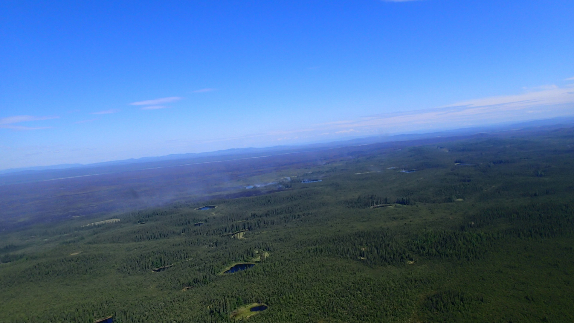
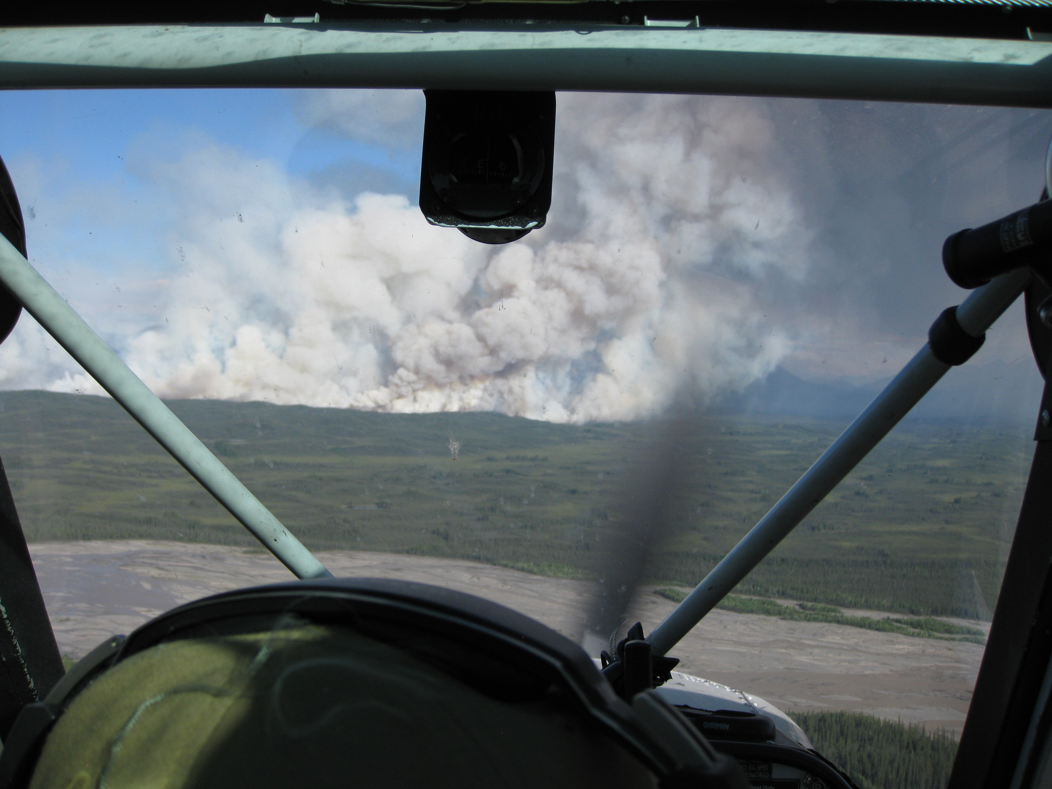
Due to continued hot and dry conditions, the Chisana River Fire grew from 2,900 acres to 7,718 acres June 17. The wildfire moved south from Tetlin Wildlife Refuge into northeastern Wrangell-St. Elias NP. As of June 17, the wildfire had
burned 3,847 acres in Tetlin Wildlife Refuge and 3,871 acres in Wrangell-St. Elias NP. The increased fire activity resulted in a 10,000 foot column of smoke that was visible from the Alaska Highway in Yukon Territory, Gulkana and McCarthy. Smoke from the fire can likely be seen and smelled in the Copper River Basin. Today, forecast extreme fire conditions will likely contribute to continued large fire growth and a large and visible column of smoke.

The Chisana River Fire is located 82 miles east of Slana, 37 miles northeast of Chisana, 19 miles southwest of Beaver Creek, Canada and approximately 14 miles southwest of the Alaska Highway border crossing. The U.S. Fish and Wildlife Service, Wrangell-St. Elias NP and State of Alaska Division of Forestry fire staff will continue to monitor the fire closely, documenting fire behavior and growth. Interagency fire managers will take action if structures, natural or cultural resources are threatened. None are threatened at this time. Fire managers are also communicating with Yukon Territory officials on a daily basis.

Staff are allowing the wildfire to take its natural course. Wildfire is a natural process in the boreal forest. It is nature's way of renewing and revitalizing the landscape. Naturally-caused wildfires have on occasion burned in the northeastern portion of Wrangell-St. Elias and Tetlin National Wildlife Refuge. Visit http://www.nps.gov/wrst/parkmgmt/loader.cfm?csModule=security/getfile&pageID=385664 to see a map of the area's wildfire history.

Visit http://www.nps.gov/wrst/parkmgmt/currentfireinfo.htm for current fire information.

Saturday, June 15, 2013

Four lightning caused wildfires in northeastern Wrangell St Elias NP, two active, one quiet, one out

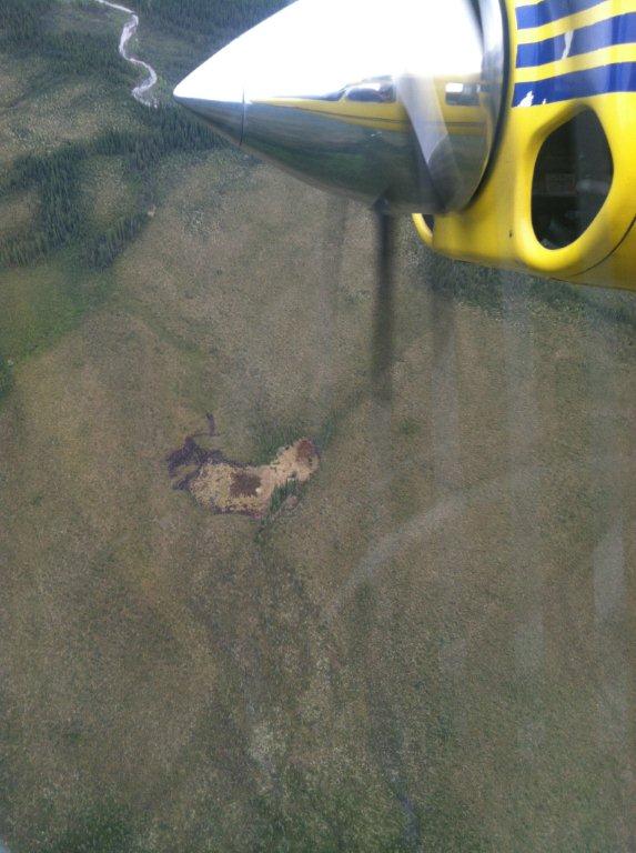
Copper Center, Alaska – A new wildfire was spotted by State of Alaska Division of Forestry (DOF) fire staff June 11 in northeastern Wrangell-St. Elias NP. The Bruin Creek fire is 73 miles southeast of Slana, 22 miles northeast of Chisana, 28
miles west of Beaver Creek, Canada and 16 miles southwest of the Chisana River Fire. At 2 acres, the fire was inactive except for a few smokes. Wrangell-St. Elias NP and DOF fire staff will monitor the fire closely.

Two park cabins are nearly 3 miles southeast of the Bruin Creek Fire. Today six interagency fire staff will remove brush around the cabins to make them defensible should the fire activity increase and advance toward the structures. Staff will also set up sprinkler kits in order to wet down the structures and reduce the fire risk. Temperatures in the area are expected to stay warm and dry.

The Chisana River Fire located 82 miles east of Slana, 37 miles northeast of Chisana and 19 miles northwest of Beaver Creek, Canada is 3175 acres. The majority of the fire burns in the Tetlin National Wildlife Refuge. Twenty-nine acres are in northeastern Wrangell-St. Elias National Park. The U.S. Fish and Wildlife Service, Wrangell-St. Elias NP and DOF fire staff will continue to monitor the fire, documenting fire behavior and growth. Staff are allowing the fire to take its natural course for the health of the boreal forest. Interagency fire managers will take action if structures, natural or cultural resources are threatened.

A quiet Edge Creek Fire was reported June 12. Less than ¼ acre, the fire is located just north of the Bruin Creek Fire and will be monitored by Wrangell-St. Elias and DOF fire staff.

When detected June 5, the 1 acre Tractor Trail Fire was out. Located south of the Bruin Creek Fire, it likely was ignited by lightning, burned for a short period of time and then rain extinguished it.

Naturally-caused wildfires have on occasion burned in the northeastern portion of Wrangell-St. Elias. Visit http://www.nps.gov/wrst/parkmgmt/loader.cfm?csModule=security/getfile&pageID=385664 to see a map of the park's wildfire history.

Visit http://www.nps.gov/wrst/parkmgmt/currentfireinfo.htm for current fire information.

For additional information please contact Mark Keogh at 907-822-7223.

Tuesday, February 12, 2013

Alaskas National Parks Invite Public Comment on Each Parks Compendium Through February 15 2013


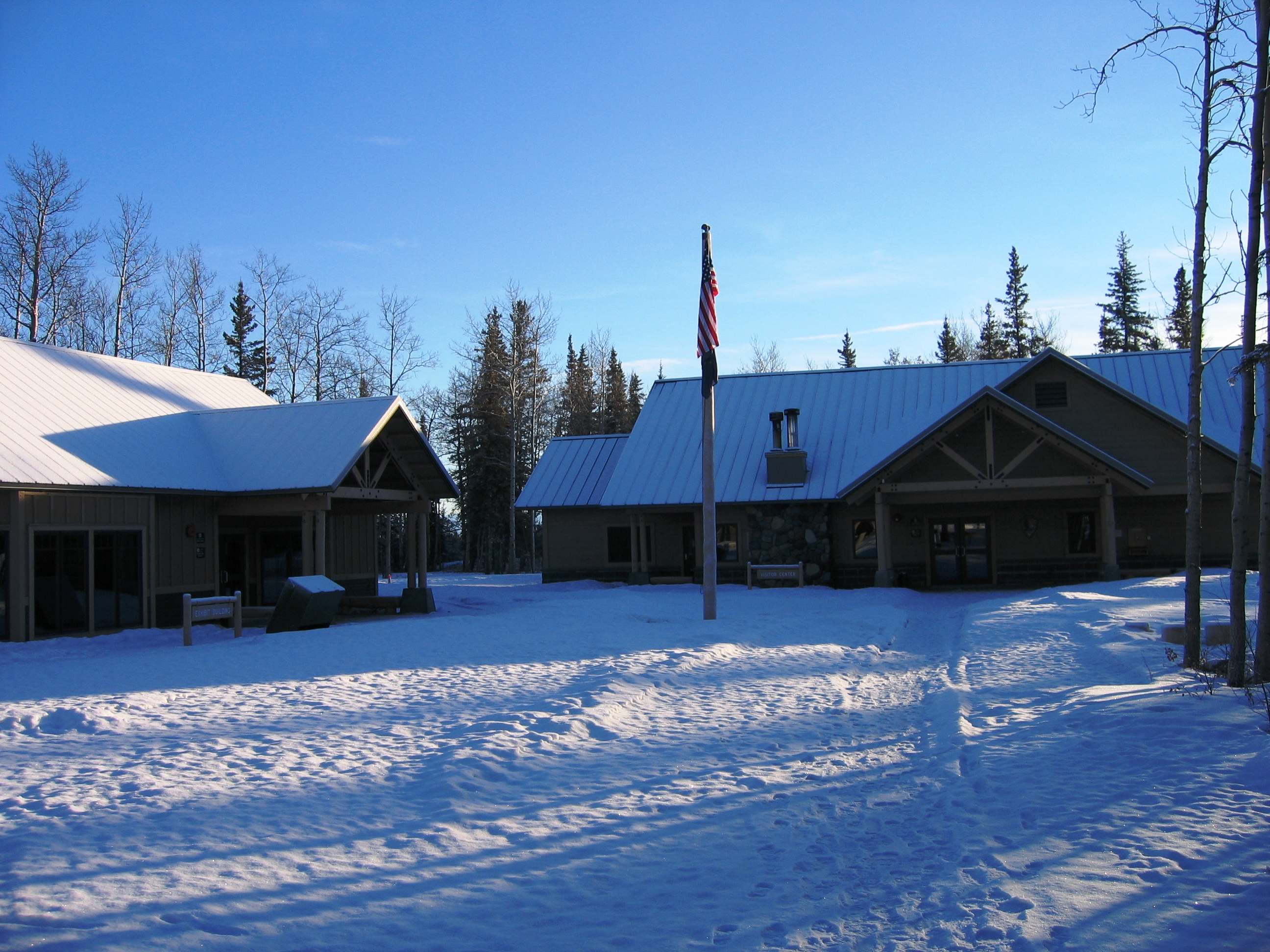
Wrangell-St. Elias Headquarters Visitor Center
The compendium is a compilation of all designations, closures and restrictions imposed under the discretionary authority within the regulations covering national parks. The compendium is a regulatory tool to help manage Alaska's national park areas for the public's enjoyment, use and protection.
This year, several NPS areas in Alaska are proposing restrictions to taking wildlife in national preserves. These proposals are based on recent changes in State of Alaska regulations pertaining to the take of wolves, coyotes, and bears in some game management units, including certain national preserves. Other proposed changes include the closure of an old trail in Wrangell-St. Elias where a newly constructed trail reaches the same destination, and human waste disposal practices in Glacier Bay.
The NPS is proposing to prohibit the take of wolves and coyotes between May 1 and August 9 in the following national preserves:Denali, Gates of the Arctic, Katmai, Aniakchak, Alagnak Wild River, Lake Clark, Wrangell-St. Elias, and Yukon-Charley Rivers. In some or all areas within these preserves, the State of Alaska now allows wolves and coyotes (including pups) to be taken in late spring and summer when the animals are denning and raising vulnerable offspring. The proposed shortening of the wolf and coyote season will protect animals at the den and during the period when their pelts have little economic or trophy value. It will also protect a subsistence opportunity for taking that wolf or coyote later in the year when their coats are prime in order to sell the pelt for cash.The proposed shorter season is also more consistent with federal subsistence regulations.
The proposed compendiums for Denali, Wrangell-St. Elias and Yukon-Charley Rivers include a prohibition on the taking of brown bears at a bait station. Bait stations typically consist of things such as grease or dog food set in a location that will attract the desired animal where it can then be taken. The public safety concerns posed by food-conditioned bears are widely recognized. These bears are more likely to be a danger to humans, and it is incongruent with best management practices and public educational messaging found in national park areas on the issue of food and bears.
The NPS also proposes to renew a temporary prohibition on using artificial light to take blackbears at dens and taking black bear sows with cubs at dens in Denali and Gates of the Arctic National Preserves.
Consistent with sound management principles and conservation of wildlife, practices that disturb animals when they are in a vulnerable state - in dens, when reproducing, or very young - are usually avoided.Accordingly, these practices have generally been prohibited under federal subsistence and state harvest regulations.Additionally, management practices that seek to increase harvest of predators in order to boost populations of prey species are not consistent with the management of National Park Services areas which are to retain naturally dynamic wildlife populations.
Public involvement in the compendium process began in early December when the National Park Service held the first of seven public hearings to hear input as these restrictions were being drafted. After this round of public comment on the compendium provisions ends on February 15, the NPS will consider revisions and expects to publish the final compendiums in April 2013.
Each park's proposed 2013 compendium is available at:http://www.nps.gov/akso/management/compendiums.cfm. A written copy may be requested directly from the park or the National Park Service, 240 W. 5th Avenue, Anchorage, AK99501, Attn:Compendium.
Comments will be accepted by mail or e-mail between January 15 and February 15, 2013. Comments are welcome at any time in addition to this timeframe, but comments received after February 15 will be considered in future compendium revisions.

Monday, August 13, 2012

Federal subsistence hunting permits for Wrangell St Elias National Park and Preserve available

Welcome sign at the entrance to Wrangell–St. E...
(Photo credit: Wikipedia)
Federal subsistence registration permits for permit hunts in Wrangell-St. Elias National Park and Preserve are available at the park's Visitor Center in Copper Center, the Slana Ranger Station, and the Chitina Ranger Station.Please bring your State of Alaska resident hunting license, a photo ID (such as a driver's license), and proof of your local physical address (such as a voter registration card or utility bill listing the physical address) when you come to get a permit. Regular season sheep hunters, make sure you get a state harvest ticket and seal the horns. For more information, call 822-5234.

Thursday, April 19, 2012

Wrangell St Elias To Hold Public Hearing Regarding Closure of Malaspina Forelands To Use Of Off-Road Vehicles For Subsistence

Ponds of water on a glacier, Wrangell-St. Elia...
(Photo credit: Wikipedia)
Copper Center, AK - The Wrangell-St. Elias National Park and Preserve is proposing to close the Malaspina Forelands and other lands in its Yakutat District to the use of off-road vehicles (ORVs) for subsistence access. The closure is needed to prevent damage to park resources. It would apply to all portions of the Park and Preserve south of the Bagley Ice Field and Seward Glacier, extending east to the western margin of the Hubbard Glacier. A public hearing on the proposed closure will be held at the National Park Service's Yakutat Visitor Center on Tuesday, April 17, 2012, from 4 PM to 6 PM.

Local users including the Wrangell-St. Elias Subsistence Resource Commission have recommended that the Park Superintendent implement this closure to prevent damage to park resources on the Malaspina Forelands. The use of ORVs on the nearby Yakutat Forelands, even in the presence of regular monitoring and enforcement, has led to extensive resource damage in a relatively short period of time. Current NPS staffing in Yakutat does not allow for monitoring at the frequency needed to successfully address and prevent resource damage. This closure would be in effect until a determination by the Superintendent concludes that ORV use in this area no longer represents an unacceptable adverse impact on the resource.

Less restrictive measures will not be effective are because the park does not currently have the capacity to effectively monitor use or enforce permit conditions.A complete closure is the only option that can be adequately enforced at this time.

This closure would be a seasonal closure in effect only during summer months. During winter periods in which there is 6-12 inches of snow or more, or a combination of snow and frost depth sufficient to protect underlying vegetation and soil, these areas will be open to over snow vehicles. Use of ORVs will still be authorized for commercial fishermen under the authority of 36 CFR 13.40(c), and/or by permit issued by the Superintendent.

A map of the closed area is available for public inspection at the park headquarters in Copper Center, at the NPS Yakutat Visitor Center, at the Yakutat Post Office, and on the park web site at http://www.nps.gov/wrst/parkmgmt/subsistence-maps.htm.

Additional information may be obtained by calling Rick Obernesser, Superintendent, 907-822-5234.