Sunday, June 30, 2013

Heavy Rain Slows Chisana River Fire


June 29, 2013
Beaver Creek, Yukon –– Heavy rain has dampened growth and activity on the Chisana River Fire in Alaska’s Eastern Interior. As a result, the international team managing the fire from Beaver Creek, Yukon, Canada is disbanding after a productive, cooperative effort. The Alaska Division of Forestry will continue to monitor the fire.

The fire was started by lightning May 31and is burning in Wrangell-St. Elias National Park and in the Tetlin National Wildlife Refuge. It is estimated at approximately 45,950 acres. The slight decrease in acreage from the previous estimate is due to better mapping of the fire.

No resources are threatened by the fire, but fire managers have developed contingency plans and are prepared to take action if that changes. The fire is approximately 13 miles west of the Canadian border, 17.5 miles west of Beaver Creek, Yukon, Canada and 21 miles northeast of Chisana.

Saturday, June 22, 2013

Rain takes toll on Wrangell-St. Elias's Chisana Blaze

Rain has helped to slow the growth of the Chisana River Fire and moderated the
spread of smoke. The fire, which was started by lightning on May 21, has grown to 29,910 acres.The fire made small movements to the east in parts of Wrangell-St. Elias National Park and the Tetlin National Wildlife Refuge.It remains approximately 13 miles from the Alaska Highway and 18 miles west of Beaver Creek, Yukon, Canada.

The State of Alaska Division of Forestry is monitoring the fire closely and consulting with the fire management officers from the U.S. Fish and Wildlife Service, National Park Service, and Yukon Territory in Canada. Despite the rain, vegetation in the area remains dry and conditions can change rapidly. Fire managers will take action if structures or natural or cultural resources are threatened, based on statewide firefighting priorities and resources available. None are threatened at this time.

The fire has created a smoky haze over the Alaska Highway, however visibility remains good.If smoke impacts the highway, motorists are asked to use caution by slowing down and driving with their headlights on.Updated information on travel conditions can be found at http://511.alaska.gov.

Wildland fire smoke information is available at http://www.dec.state.ak.us/air/smokemain.htm.

A Fuels and Fire Behavior Advisory remains in effect for most of Alaska, due to record heat and dry fuels.Read more at: http://fire.ak.blm.gov/content/weather/outlooks/FFBehavior.pdf.

Information will be updated when significant changes in fire activity occur. . Information about fires burning on National Park Service lands throughout Alaska is provided at http://www.nps.gov/wrst/parkmgmt/currentfireinfo.htm

Friday, June 21, 2013

Chisana River Fire Growth Slows

Copper Center, Alaska –– The Chisana River Fire activity slowed on June 19 moving in a southerly direction on the east side of the River with isolated and group torching.The fire grew from 25,566 to 29,287 acres. Wednesday's actions
included precautionary site protection for two cabins-- sprinklers and removal of flammable vegetation -- and the fire was mapped to determine the perimeter.

The fire is located 82 miles east of Slana, 21 miles northeast of Chisana, 19 miles west of Beaver Creek, Canada and approximately 14 miles southwest of the Alaska Highway border crossing. The State of Alaska Division of Forestry is monitoring the fire closely to document fire behavior and growth, while consulting with the fire management officers from the U.S. Fish and Wildlife Service, National Park Service, and Yukon Territory in Canada. Fire managers will take action if structures or natural or cultural resources are threatened. None are threatened at this time. The fire will be flown again at 5:00 p.m. today.

Information will be updated when significant changes in fire activity occur. Information and photos are also available at http://inciweb.org/incident/3440/.

Smoke will be visible and even heavy at times, in both Alaska and Canada. In Alaska, smoke will be likely visible throughout the Copper River Basin, from the Alaska-Canada border crossing, and along portions of the Alaska Highway. Wildland fire smoke information is available at http://www.dec.state.ak.us/air/smokemain.htm. If smoke becomes an impact to the highway, motorists are asked to use caution by slowing down and driving with their headlights on.

Several fires are burning statewide. For interagency wildland fire information, visit http://fire.ak.blm.gov or call 907-356-5511. Information about fires burning on National Park Service lands throughout Alaska is provided at http://www.nps.gov/wrst/parkmgmt/currentfireinfo.htm. For additional information, please contact Mark Keogh at 907-822-7223.

Thursday, June 20, 2013

Chisana River Fire Grows, Impacts the Copper River Valley

Smoke from the Chisana River Fire impacted the Copper River basin on the evening of July 18. Because the fire continues to grow anticipate varying levels of
smoke impacting the area.

The Chisana River fire grew from 7,718 acres on June 17 to 25,566 acres on June 18. The fire continued its growth to the south and west with some growth east - isolated tree torching and short range spotting was observed. Interagency fire staff provided protection to a structure that is southwest of the fire. The fire will continue to be monitored with planned flights today around 5:00pm.

The fire is located 82 miles east of Slana, 21 miles northeast of Chisana, 19 miles west of Beaver Creek, Canada and approximately 14 miles southwest of the Alaska Highway border crossing. The State of Alaska Division of Forestry is monitoring the fire closely to document fire behavior and growth, while consulting with the fire management officers from the U.S. Fish and Wildlife Service, National Park Service, and Yukon Territory in Canada.

Smoke will be visible and even heavy at times, in both Alaska and Canada. In Alaska, smoke will be likely visible throughout the Copper River Basin, from the Alaska-Canada border crossing, and along portions of the Alaska Highway. Wildland fire smoke information is available at http://www.dec.state.ak.us/air/smokemain.htm. If smoke becomes an impact to the highway, motorists are asked to use caution by slowing down and driving with their headlights on.

The fire is in a Limited suppression management option, per the Alaska Interagency Wildland Fire Management Plan. Wildfire is a natural process in the boreal forest. The fire is burning on U.S. Fish and Wildlife and National Park Service lands and agency personnel are allowing the wildfire to take its natural course.It is nature's way of renewing and revitalizing the landscape. Naturally-caused wildfires have on occasion burned in the northeastern portion of Wrangell-St. Elias and Tetlin National Wildlife Refuge. Interagency fire managers will take action if structures, natural or cultural resources are threatened. None are threatened at this time. Visit http://www.nps.gov/wrst/parkmgmt/loader.cfm?csModule=security/getfile&pageID=385664 to see a map of the area's wildfire history.

Several fires are burning statewide. For interagency wildland fire information, visit http://fire.ak.blm.gov or call 907-356-5511. Information about fires burning on National Park Service lands throughout Alaska is provided athttp://www.nps.gov/wrst/parkmgmt/currentfireinfo.htm. For additional information, please contact Mark Keogh at 907-822-7223.

Denali Moose Shooting Update: No Prosecution of Shooter Planned

Moose
Moose (Photo credit: Travis S.)
On Thursday, June 6 at approximately 7:30 pm the National Park Service received a report that a visitor had shot and injured a cow moose near the Denali Visitor Center. The visitor, Robert Sirvid, age 26, of Eagle River, Alaska stated that he and four other people, including two small children, encountered the moose at close range when they rounded a corner of the trail. They attempted to hide behind a tree, but the moose continued to charge. As she approached, Sirvid shot her at close range in the head. He stated afterwards that he did it because he was concerned for the safety of the children and felt he had no other recourse. He was visibly upset when he reported the incident to the responding rangers, who had to destroy the mortally injured moose.

After investigation of the statements of the party and a review of applicable law, the National Park Service has determined that no prosecution will be recommended to the Office of the United States Attorney.

The discharge of the firearm in the park is a violation of both 36 CFR 2.3(a)(1)(iii) and 2.2(a)(1) – using a weapon and taking of wildlife. Sirvid stated that he shot the moose to defend the lives of the children, and nothing found in the investigation contradicted that statement. While there is not a “defense of life” provision in the federal laws governing national parks, under Alaska State law this incident would be deemed a justifiable defense of life and not be charged as an offense. National Park Service wildlife biologists are actively following up on leads regarding two apparently orphaned moose calves that have been seen regularly in the area since the shooting. If the calves are located, the National Park Service will work with the Alaska Moose Federation to capture them and transfer them to a wildlife rehabilitation facility.

Wednesday, June 19, 2013

Amazing Images of Alaska Wildfire

Due to continued hot and dry conditions, the Chisana River Fire grew from 2,900 acres to 7,718 acres June 17. The wildfire moved south from Tetlin Wildlife Refuge into northeastern Wrangell-St. Elias NP. As of June 17, the wildfire had
burned 3,847 acres in Tetlin Wildlife Refuge and 3,871 acres in Wrangell-St. Elias NP. The increased fire activity resulted in a 10,000 foot column of smoke that was visible from the Alaska Highway in Yukon Territory, Gulkana and McCarthy. Smoke from the fire can likely be seen and smelled in the Copper River Basin. Today, forecast extreme fire conditions will likely contribute to continued large fire growth and a large and visible column of smoke.

The Chisana River Fire is located 82 miles east of Slana, 37 miles northeast of Chisana, 19 miles southwest of Beaver Creek, Canada and approximately 14 miles southwest of the Alaska Highway border crossing. The U.S. Fish and Wildlife Service, Wrangell-St. Elias NP and State of Alaska Division of Forestry fire staff will continue to monitor the fire closely, documenting fire behavior and growth. Interagency fire managers will take action if structures, natural or cultural resources are threatened. None are threatened at this time. Fire managers are also communicating with Yukon Territory officials on a daily basis.

Staff are allowing the wildfire to take its natural course. Wildfire is a natural process in the boreal forest. It is nature's way of renewing and revitalizing the landscape. Naturally-caused wildfires have on occasion burned in the northeastern portion of Wrangell-St. Elias and Tetlin National Wildlife Refuge. Visit http://www.nps.gov/wrst/parkmgmt/loader.cfm?csModule=security/getfile&pageID=385664 to see a map of the area's wildfire history.

Visit http://www.nps.gov/wrst/parkmgmt/currentfireinfo.htm for current fire information.

Monday, June 17, 2013

Weather and Climate Monitoring Stations Proposed for Glacier Bay

English: Glacier Bay taken by myself in Septem...
Quentin Goodman
Why monitor climate in Glacier Bay?

The National Park Service Southeast Alaska Inventory & Monitoring Network (SEAN) designs and operates long-term ecological inventory and monitoring programs for Southeast Alaska parks including Glacier Bay National Park and Preserve. Weather and climate is one of the park's 12 priority Vital Signs.  Detecting changes in climate will inform managers about a broad range of resource effects including glacial ice mass wasting, shifts in marine salinity and nutrients, timing and abundance of marine mammal prey, forest and early successional plant community advance, spread of invasive species, and adjusting park infrastructure to more intense storm events or rising sea levels.

What would monitoring stations do?Remote Automated Weather Stations (RAWS) record air and soil temperature, precipitation, relative humidity, wind, solar radiation, and snow depth data.  Stations are powered by solar panel, wind generator, or methanol fuel cell. In addition to storing data, each station also transmits hourly weather conditions and sensor condition by satellite.

Where would stations be located?

A grid of stations would be designed to capture conditions along the west-east, north-south, and high-low elevation gradients in the park.  Sites in Lituya Bay, Dry Bay, Deception Hills, Queen Inlet, Lone Island, upper Muir Inlet, and Brady Icefield, are being considered.

Where can I learn more about the SEAN Climate and Weather monitoring program?

Follow this link to read more about how the SEAN Climate and Weather Inventory and Monitoring program is being developed.

http://science.nature.nps.gov/im/units/sean/AuxRep/0_SEAN/0_SEAN%20Climate%20Inventory_final.pdf

What's Next?

The National Park Service (NPS) is asking for your questions and comments on the climate station program so they can be considered early in the development of the Environmental Assessment (EA). Park resources that may be affected by such installations include wilderness value and character, visitor experience, vegetation and soils, terrestrial wildlife, and culturally sensitive areas.  If you have questions about the proposed climate station program please contact Allison Banks by phone at 907-697-2611, by email at e-mail us or by postal mail at: Glacier Bay National Park and Preserve, P.O. Box 140, Gustavus, AK 99826

An informational public meeting will be held at the

Gustavus Public Library

Wednesday, June 26, 2013, 4:00-6:00 pm and 7:00-9:00 pm

Please submit your issue comments by July 17, 2013.  An EA analyzing the potential effects of climate station installations will be prepared this summer.  A 30-day public review of the environmental assessment could take place by September, 2013.  Station installations may begin in 2014

Sunday, June 16, 2013

BLM, Tribes Continue Dialogue on Hydraulic Fracturing Rule

English: Bureau of Land Management logo

Building on the eight outreach sessions held last year with Tribal communities and the 22 formal one-one-one tribal consultations, the Bureau of Land Management (BLM) has scheduled two additional regional outreach meetings with Tribal representatives to discuss how the Bureau’s proposed hydraulic fracturing rule would strengthen oil and gas operations on Indian trust lands.

The announcement of the meetings – planned for June 18 in Dickinson, ND, and June 20 in Farmington, NM – comes in conjunction with the publication of a revised proposed rule on hydraulic fracturing on public and Indian lands on May 24 in Federal Register.

Following the release of an initial draft proposal in 2012, Interior received extensive feedback, including over 177,000 public comments as well as suggestions from Indian tribes that helped inform the updated draft proposal.  The new proposal maintains important safety standards, improves integration with existing state and tribal standards, and increases flexibility for oil and gas operators.  The updated draft proposal is subject to a new 90-day public comment period, which ends on August 23, 2013.

“For more than a year, the BLM and many Indian tribes have engaged in a dialogue – both through regional meetings and government-to-government consultation – in which many clear and valid points were made about what a hydraulic fracturing rule needs to do,” said BLM Principal Deputy Director Neil Kornze.

“We believe the revised rule enables us to meet our trust responsibilities for oil and gas development on Indian lands, while recognizing issues such as sovereignty, economic development, and water rights,” Kornze said.

The Indian Mineral Leasing Act authorizes the Secretary of the Interior, who oversees the BLM, to administer the oil and gas leasing program under regulations specific to Indian trust lands, in an effort to provide the same protections to these lands that are accorded to public lands.

Last year, the BLM held eight separate outreach sessions for Tribal communities in addition to 22 formal one-to-one Tribal consultations.

At this year’s regional meetings, BLM staff will present background information regarding hydraulic fracturing, explain the current provisions of the rule, and how it was revised to address tribal concerns.   The program will also include time to answer questions and take suggestions.

The revised rule supports the Obama Administration’s all-of-the-above commitment and approach to American energy by expanding domestic oil and gas production in order to further American energy self-reliance, while remaining focused on ensuring safe and responsible development on public and Indian lands.

Approximately 90 percent of wells drilled on Federal and Indian lands use hydraulic fracturing, but the BLM’s current regulations governing hydraulic fracturing operations on public and Indian lands are more than 30 years old and were not written to address modern hydraulic fracturing activities. The revised proposed rule will modernize BLM’s management of hydraulic fracturing operations, and help to establish baseline environmental safeguards for these operations across all public and Indian lands.

The updated draft proposal maintains the three main components of the initial proposal: requiring operators to disclose the chemicals they use in fracturing activities on public lands; improving assurances of well-bore integrity to verify that fluids used during fracturing operations are not contaminating groundwater; and confirming that oil and gas operators have a water management plan in place for handling fluids that flow back to the surface.

Representatives of tribes with interests in oil and gas development are invited to attend one of the following two meetings:

– June 18, 9 a.m. – 5 p.m.

Ramada Grand Dakota Lodge and Conference Center, 532 15th Street West, Dickinson, ND, 58601. Reservations: 800-422-0949 (a limited number of rooms at a conference rate are available).

– June 20, 9 a.m. to 5 p.m.

San Juan Community College, Computer Science Building Lecture Hall, 4601 College Blvd., Farmington, NM, 87402. Information: Patrick Papich, BLM Farmington Field Office, 505-320-5161.

Saturday, June 15, 2013

Russian River Fishing Season

English: Black Bear in Russian River, Kenai Na...
Black Bear in Russian River, Kenai National Wildlife Refuge (Photo credit: Wikipedia)
Angler and visitor responsibility and respect to natural and cultural resources is key to a safe season Cooper Landing, Alaska— The Kenai-Russian River area, located on the Chugach National Forest and Kenai National Wildlife Refuge, is an intensively used fishing and recreation area, valued by anglers, federally qualified subsistence users, and other visitors for its easy access. High human use
between the months of May and September, coupled with abundant fishery resources, has led to public and employee safety concerns and impacts to the resources in the area.

The agencies managing this area are asking visitors to be responsible with their actions to ensure respect for the area’s waters, fish, wildlife, and cultural sites.
The 2013 interagency priorities include responsibly managing retained fish, human food and human generated waste (including fish waste) responsibly to reduce the potential for human-bear conflicts.

Food Storage Regulation
A food storage regulation is in effect on both the National Forest System lands and US Fish and Wildlife Service lands and waters in the area. All attractants (for example: food, beverages, and garbage) and equipment used to cook or store food (for example: coolers and backpacks) must be acceptably stored (in a bear resistant container, in your vehicle, or kept within 3 feet of you at all
times).

Retained Fish in Possession Regulation 
Fish must be kept within 12 feet of you all at times to ensure that bears do not attain your fish.

Fish Waste Management
To minimize the attainment of fish waste from bears during the 2013 field season, anglers are being asked to help by following the requests below:
Take fish out whole – Please take fish out whole when possible (gutting and gilling is acceptable) and manage fish waste offsite in a responsible manner based on local solid waste standards.
Process fish only at established fish cleaning facilities- If you must clean onsite, please use fish cleaning tables at the confluence or ferry site and chop fish waste into numerous small pieces and throw into fast-moving river current.

“Do Your Part” – Help move fish waste downstream by regularly moving any fish waste you encounter along the shore or hanging up on rocks into faster moving water so it will move downstream.

Visitors are also strongly encouraged to respect the areas that are fenced or roped off to protect sensitive plants and cultural sites. They need to stay on maintained and established trails and
boardwalks. Visitors are also strongly requested to use the public restroom facilities that are dispersed throughout the area due to the potential of disturbing sensitive cultural sites along the river corridor.

A Russian River Interagency Coordination Group was formed in 2006 to coordinate management of public resources of the Russian River area. The group includes representatives from the USDA Forest Service; U.S. Fish and Wildlife Service; Alaska Department of Fish and Game, Divisions of Wildlife and Sport Fish; Alaska Department of Natural Resources, Division of Parks and Outdoor
Recreation; Cook Inlet Region Incorporated; and the Kenaitze Indian Tribe.

In February 2013, a five-year action plan was finalized that outlines actions that will be implemented to reduce the potential for human-bear conflicts in the Kenai-Russian River area. To view summaries from the public process or to view the final plan, please visit https://projects.ecr.gov/kenai-russianriver/default.aspx

Four lightning caused wildfires in northeastern Wrangell St Elias NP, two active, one quiet, one out

Copper Center, Alaska – A new wildfire was spotted by State of Alaska Division of Forestry (DOF) fire staff June 11 in northeastern Wrangell-St. Elias NP. The Bruin Creek fire is 73 miles southeast of Slana, 22 miles northeast of Chisana, 28
miles west of Beaver Creek, Canada and 16 miles southwest of the Chisana River Fire. At 2 acres, the fire was inactive except for a few smokes. Wrangell-St. Elias NP and DOF fire staff will monitor the fire closely.

Two park cabins are nearly 3 miles southeast of the Bruin Creek Fire. Today six interagency fire staff will remove brush around the cabins to make them defensible should the fire activity increase and advance toward the structures. Staff will also set up sprinkler kits in order to wet down the structures and reduce the fire risk. Temperatures in the area are expected to stay warm and dry.

The Chisana River Fire located 82 miles east of Slana, 37 miles northeast of Chisana and 19 miles northwest of Beaver Creek, Canada is 3175 acres. The majority of the fire burns in the Tetlin National Wildlife Refuge. Twenty-nine acres are in northeastern Wrangell-St. Elias National Park. The U.S. Fish and Wildlife Service, Wrangell-St. Elias NP and DOF fire staff will continue to monitor the fire, documenting fire behavior and growth. Staff are allowing the fire to take its natural course for the health of the boreal forest. Interagency fire managers will take action if structures, natural or cultural resources are threatened.

A quiet Edge Creek Fire was reported June 12. Less than ¼ acre, the fire is located just north of the Bruin Creek Fire and will be monitored by Wrangell-St. Elias and DOF fire staff.

When detected June 5, the 1 acre Tractor Trail Fire was out. Located south of the Bruin Creek Fire, it likely was ignited by lightning, burned for a short period of time and then rain extinguished it.

Naturally-caused wildfires have on occasion burned in the northeastern portion of Wrangell-St. Elias. Visit http://www.nps.gov/wrst/parkmgmt/loader.cfm?csModule=security/getfile&pageID=385664 to see a map of the park's wildfire history.

Visit http://www.nps.gov/wrst/parkmgmt/currentfireinfo.htm for current fire information.

For additional information please contact Mark Keogh at 907-822-7223.

Tuesday, June 11, 2013

Anchorage teens find more than just a summer job on public lands

When Alex Zimmerman was young, she loved the outdoors and told people she
Courtesy USFS
wanted to be a “bug scientist” when she grew up. But her career plans really began to take shape last year when she was accepted into Youth Employment in Parks (YEP), a program of the Anchorage Parks and Recreation Department and the Anchorage Park Foundation that provides a meaningful "first job" experience and career pathway for youth to work in the outdoors and natural resources fields.
“I started to know where I wanted to go,” she said. “I want to become a park ranger.” But it was hard to find a job after YEP. “Eventually I got a job as a house cleaner and I thought, what am I going to do with the rest of my life?” Alex remembers.

Now, thanks to a partnership between the Student Conservation Association (SCA), the Municipality of Anchorage, the Anchorage Park Foundation, Bureau of Land Management (BLM), and Chugach National Forest, Alex at least knows what her immediate next step looks like.

Alex and four other alumni from YEP were selected for a new summer conservation crew experience sponsored by the five partners and led by seasoned SCA staff. The crew, made up of participants ages 17-20, will take part in a ten week work experience on municipal and federal public lands. Starting this week they’ll work for the BLM at Campbell Track helping to clear hazard trees from popular recreation trails. In mid-June they’ll work on city lands. And from July 6th to August 3rd they’ll have their most remote experience working alongside a Forest Service trail crew at the Spencer Whistle Stop on the Chugach National Forest.

When she got the phone call letting her know she had been selected, Alex said, “I felt like something was lifted off my shoulders.”

It was made possible in part by a nearly $40,000 cost-share grant from the US Forest Service. The award was announced on May 9th by US Forest Service Chief Tom Tidwell as part of a $772,820 package of More Kids in the Woods and Children’s Forest grants in 16 states and the U.S Virgin Islands. Local partners added an additional $65,000 match to the grant.

Amanda Smith, head of partnership development for the Alaska Region of SCA said, "Youth are motivated and starved to find work opportunities. A strong group of partners worked together to build a career pathway for youth who are already interested and experienced in natural resource management, but have limited options for their next resource management job. It's nice to see these efforts recognized with Forest Service funding."

Added Smith, "The youth will experience some of Alaska's most visited public lands and feel the benefits of hard work and commitment."

For Beth Nordlund, Executive Director of the Anchorage Park Foundation, that was one the primary reasons to partner. “We want to give YEP returning teens experience in public lands outside of Anchorage. They have worked in urban parks for a summer, and now they’re working on spike crews, in some cases in the backcountry. So it’s a very different experience. We’re excited to give kids a sense of stewardship and ownership of their federal public lands.”

Getting outside of Anchorage is something that appeals to the participants, as well. Crew member Shawna Strain grew up in Southeast Alaska where, “we were out in the woods, building forts all the time. When I moved to Anchorage I wasn’t doing that anymore. The city seemed so big compared to where I came from.”

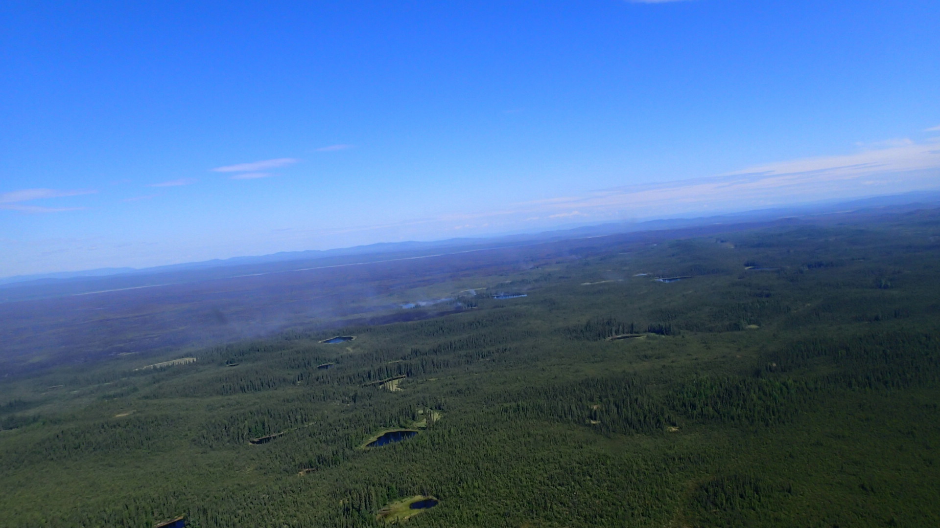
Inspiring youth to check out the city’s neighboring public lands has been a focus for the Chugach National Forest for many years, and in 2008 Forest leaders bolstered this commitment by launching the Chugach Children’s Forest with non-profit partner Alaska Geographic. Since then, over 20,000 youth, volunteers and educators have been engaged in outdoor education programming, career opportunities, stewardship expeditions and volunteer outings as part of the initiative.

“People come from all over the world to experience the Chugach National Forest and Alaska’s public lands, yet young people from many Anchorage neighborhoods have never set foot in the Forest,” Terri Marceron, Forest Supervisor on the Chugach National Forest said. “One of our goals is to simply get youth outdoors learning about natural resource work and having fun. We need their ideas and leadership to help solve the challenges of today and tomorrow –from climate change to maintaining our trails and recreation opportunities for the public. These are our future land stewards.”

That message speaks to the crew members who embrace the responsibility that comes with the new opportunity. “Everything isn’t set up for us this summer. We’re learning what it takes to get the project and work done, and how to run everything,” Shawna said. “We have more leadership, like college.”

And the work is unique in another way, Alex said. “It’s more of a learning experience than anything, and that’s what I want from a job. I love that about being outside because you can always learn something new.”