Saturday, March 31, 2012

Rock Creek Bridge EA

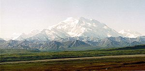
Deutsch: Mount McKinley, Denali-Nationalpark E...
 (Photo credit: Wikipedia)
The National Park Service (NPS), in cooperation with the Federal Highway Administration (FHWA), is considering replacing or retrofitting the Rock Creek Bridge on the Denali Park Road at Denali National Park and Preserve. This project would take place during the summer of 2013.
 
The Rock Creek Bridge, located just east of park headquarters, is an essential year-round link on the only road into Denali National Park. The bridge's 24-foot width, combined with its curved design, often results in westbound RV trailers and semis tracking into oncoming traffic in the eastbound lane, creating a traffic hazard. The FHWA has also identified the bridge as one of two seismically deficient bridges on the Denali Park Road.

The Environmental Assessment evaluates three action alternatives. The preferred alternative would replace the bridge with an 18-foot diameter culvert, with an embankment at the level of the existing bridge. Another alternative would include retrofitting the existing bridge for seismic stability and width. A third action alternative would include constructing a new bridge directly downstream of the existing bridge.

The NPS has published an environmental assessment (EA) for this project entitled "Rock Creek Bridge Replacement." It is available at the NPS planning website at http://parkplanning.nps.gov. The EA analyzes the impacts of the "No Action" alternative and the three action alternatives. It was completed in accordance with the National Environmental Policy Act of 1969 and the regulations of the Council on Environmental Quality (40 CFR 1508.9).

Friday, March 30, 2012

Copper River Highway Closure to Last Several Years

Map of the Copper River Highway in Alaska.
Map of the Copper River Highway in Alaska. (Photo credit: Wikipedia)

Bridge at mile 36.5 to be replaced before road can reopen.

(FAIRBANKS, Alaska) — The Department of Transportation & Public Facilities (DOT&PF) reminds residents and visitors in the Cordova area that the Copper River Highway remains closed indefinitely at mile 36 due to safety concerns at Bridge No. 339. This closure will remain in effect until the bridge is replaced, which is estimated to be several years away.

The 50-mile Copper River Highway begins in Cordova and ends at the Million Dollar Bridge. The road, frequented by hunters and recreationists, leads to campgrounds, a lodge and vast areas of proposed resource development.

DOT&PF closed Bridge No. 339 in August of 2011. The bridge is one of 11 bridges crossing the Copper River Delta. Naturally occurring changes to the water flow between channels across the delta led to a dramatic increase in the amount of water running under the bridge. Due to the increased amount of water, 50 ft of “scour”, or erosion, was observed at the bridge in 2011. The scour lowered the channel bottom and compromised the bridge structure, necessitating the closure.
Adverse effects due to the increased flow of water from the Copper River under Bridge No. 339 was first noted in 2009. In 2010, DOT&PF and the U.S. Geological Survey (USGS) began a comprehensive monitoring program at the bridge that included frequent on-site inspections and the use of bridge sensors that enabled remote observation.

Bridge No. 339 was constructed in 1977. Based on the channel configurations at that time, bridge designers estimated that water under the bridge would flow at 18,500 cubic feet per second (cfs). During the summer of 2011, USGS hydrologists measured water flows exceeding 85,000 cfs.

DOT&PF received funding in the fall of 2011 to begin the design phase of a replacement bridge; the design phase will progress through 2013, with agency permitting in 2014. Pending the availability of construction funds, the construction project could begin as early as 2015.

Private businesses hope to provide access past Bridge No. 339. For more information about access beyond the bridge, contact the Cordova Chamber of Commerce at (907) 424-7260.

DOT&PF oversees 254 airports, 11 ferries serving 33 communities, 5,700 miles of highway and 660 public facilities throughout the state of Alaska. The mission of DOT&PF is to “Get Alaska Moving through service and infrastructure.”

Thursday, March 29, 2012

Denali Road Open

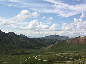
The single road within Denali National Park
The single road within Denali National Park (Photo credit: Wikipedia)
A sure sign of spring in Denali National Park and Preserve is the opening of the park road beyond park headquarters. Park visitors will be able to drive as far as the Mountain Vista Trailhead, a rest area east of the Savage River Campground, beginning at noon on Friday, March 23. Early spring offers enjoyable conditions for visiting the park, as there is good snow coverage for mushing, cross-country skiing and snowshoeing, coupled with milder temperatures and long days. Mount McKinley, or Denali, becomes visible from the park road at approximately Mile 10, weather permitting.

Vault toilets at the Mountain Vista Trailhead are open for use. Picnic tables and other rest area amenities may still be under snow. Other facilities west of park headquarters, including the Savage River Campground, remain closed until later this spring.

Visitors should expect to encounter snow and ice on shaded sections of the park road until overnight temperatures remain above freezing. Motorists are also advised to be alert for National Park Service personnel steaming culverts along the side of the road, and for heavy equipment being used in the road opening operations.

Weather conditions can change rapidly at this time of the year, and the road may open and close several times. Visitors are encouraged to call ahead for updated road and weather information. The National Park Service expects to open the road to the Savage River (Mile 15) by early April. For those interested in following the progress of the Denali road crew as they plow westward along the 92 mile park road to Kantishna, timely updates and a photo gallery are posted on the park website athttp://www.nps.gov/dena/spring-road-opening.htm

The Riley Creek Campground at Mile 0.2 is open, and camping is free until May 15. A vault toilet is provided in the loop that remains open year-round, and campers can obtain water at the Murie Science and Learning Center. Water and sewer services will not be available until mid to late May.

The Murie Science and Learning Center (MSLC) at Mile 1.3 is open daily from 9:00 am to 4:00 pm for visitor information and backcountry permits. The weekend ranger-led snowshoe walks will continue into April as long as snow conditions are favorable.

Denali National Park and Preserve collects an entrance fee year-round. The entrance fee of $10 per person (for visitors age 16 and older) is good for seven days. The majority of the money collected remains in the park to be used for projects to improve visitor services and facilities. Interagency Federal Recreation Passes such as the Annual, Senior, and Access Pass, and the Denali Annual Pass are also valid for entry into the park and can be purchased at the MSLC.  

Wednesday, March 28, 2012

Research Fellows Selected for Denali and Other Alaska National Parks

Grizzly bear in Denali National Park
Grizzly bear in Denali National Park (Photo credit: Wikipedia)
Ten researchers have been selected to be the 2012 research fellows in Denali and other northern Alaska National Parks. Six are recipients of Discover Denali Research Fellowships for research in or near Denali National Park and Preserve, and four are receiving Murie Science and Learning Center Research Fellowships for research in one of the MSLC partner parks (Bering Land Bridge, Cape Krusenstern, Denali, Gates of the Arctic, Kobuk Valley, Noatak, Wrangell-St. Elias and Yukon-Charley Rivers). This year's research fellows are primarily graduate students from University of Alaska Fairbanks (UAF), University of Alaska Anchorage (UAA) and universities outside the state. Several are faculty or staff at universities and institutions. They were selected on the significance of their proposed research to park management issues and the scientific or scholarly merit of their proposal. This component of the National Park Service's science scholarship program will sponsor excellence in science and scholarship, gain knowledge about park resources, and create the next generation of conservation scientists.
Several research fellows working in northern parks are pursuing projects related to climate change. These include one researcher who will study the impacts that herbivores, such as moose and ptarmigan, have on rapidly changing arctic shrub environments, and another who will collect observations about changes in nature's calendar (phenology) from local residents.

Research projects slated for Denali include an archeology project at Beaverlogs Lake near Lake Minchumina; an assessment of past seismic activity and slippage along the Hines Creek fault near the entrance of Denali; documentation of cultural and natural change in Denali through repeat photography; testing Denali surface and treated drinking water sources for Giardia and Cryptosporidium ; testing a winter tracking technique to monitor furbearers such as lynx and coyote; and an investigation of the relationship of nitrogen levels in leaves of bearberry, fireweed, and bunchberry that are senescing and turning red.
  
Each Discover Denali and MSLC Research Fellowship recipient will develop an educational outreach opportunity or product about their research, such as a poster, fact sheet, classroom study module for the MSLC, or a public lecture or seminar.

The research fellows and their topics are:

Discover Denali Research Fellowships:

•  Sam Coffman, University of Alaska, Museum of the North
"Sand-dune formation and human land use of Beaverlog Lakes, Denali"
  
•  Sara Federschmidt, University of Kentucky (Masters student)
"Paleoseismic and structural characterization of the Hines Creek/Park Road fault at Denali"

•  Ron Karpilo, Colorado State University, Department of Geosciences
"Documenting natural and cultural resource change using repeat photography in Denali"

•  Margie MacNeille, UAA (Masters student)
"Dynamics and red senescence in three northern plants"

•  Ricardo Santos, Instituto Superior Tecnico, Portugal
"Giardia and Cryptosporidium in surface and treated water of Denali"

•  Kelly Sivy, UAF (Masters student)
"Monitoring mesocarnivore community change in response to wolf presence, fluctuating prey, and snowpack"

Murie Science and Learning Center Research Fellowships

•  Katie Christie, UAF (Ph.D. student)
"The importance of herbivory in rapidly changing arctic shrub communities [working in Noatak and near Gates of the Arctic]

•  Margot Higgins, University of California, Berkeley (Ph.D. student)
"Understanding changes in the land using phonological observations by local residents in Wrangell-St. Elias"

•  Amanda Koltz, Duke University, North Carolina (Ph.D. student)
"Effects of climate-induced changes in generalist predators on the structure and function of Arctic food webs [near Gates of the Arctic]

•  Simon Pendleton, State University of New York, Buffalo (Masters student)
"Holocene glacial variability, Arrigetch Peaks, Alaska [Gates of the Arctic]

Short biographies and photos of this year's research fellows are posted here.

The Discover Denali Research Fellowships are made possible through proceeds from Discover Denali, an MSLC program developed in partnership between the Denali Education Center and the National Park Service. The Discover Denali program helps Royal Celebrity Tours participants learn about Denali's natural and human history. The Denali Education Center is a park partner that fosters understanding and appreciation of Denali through informative and inspiring programs.

The Murie Science and Learning Center Research Fellowships are made possible through the partnership between Alaska Geographic and the National Park Service. The Murie Science and Learning Center provides research, discovery, and learning opportunities within arctic and subarctic National Parks to promote appreciation and caring for our natural and cultural heritage. As part of its mission to connect people with their public lands, Alaska Geographic provides staffing and funding toward MSLC operations.

Both research fellowship programs are offered annually. They are particularly appropriate for graduate students, but are open to college and university faculty, undergraduates, and other researchers. Proposals for research that will help park managers make decisions about critical resource issues are encouraged. Proposals for up to $8,000 of funding to be used over one or two years are considered. Non-U.S. citizens are eligible for funding. For more information contact Research Administrator Lucy Tyrrell at 907-683-6352 or via email.