Showing posts with label wildfire. Show all posts

Sunday, July 7, 2013

Smokejumpers Provide Structure Protection for Historic Denali Patrol Cabins

Toklat East River Fire, Denali NP, 2013, Photo...
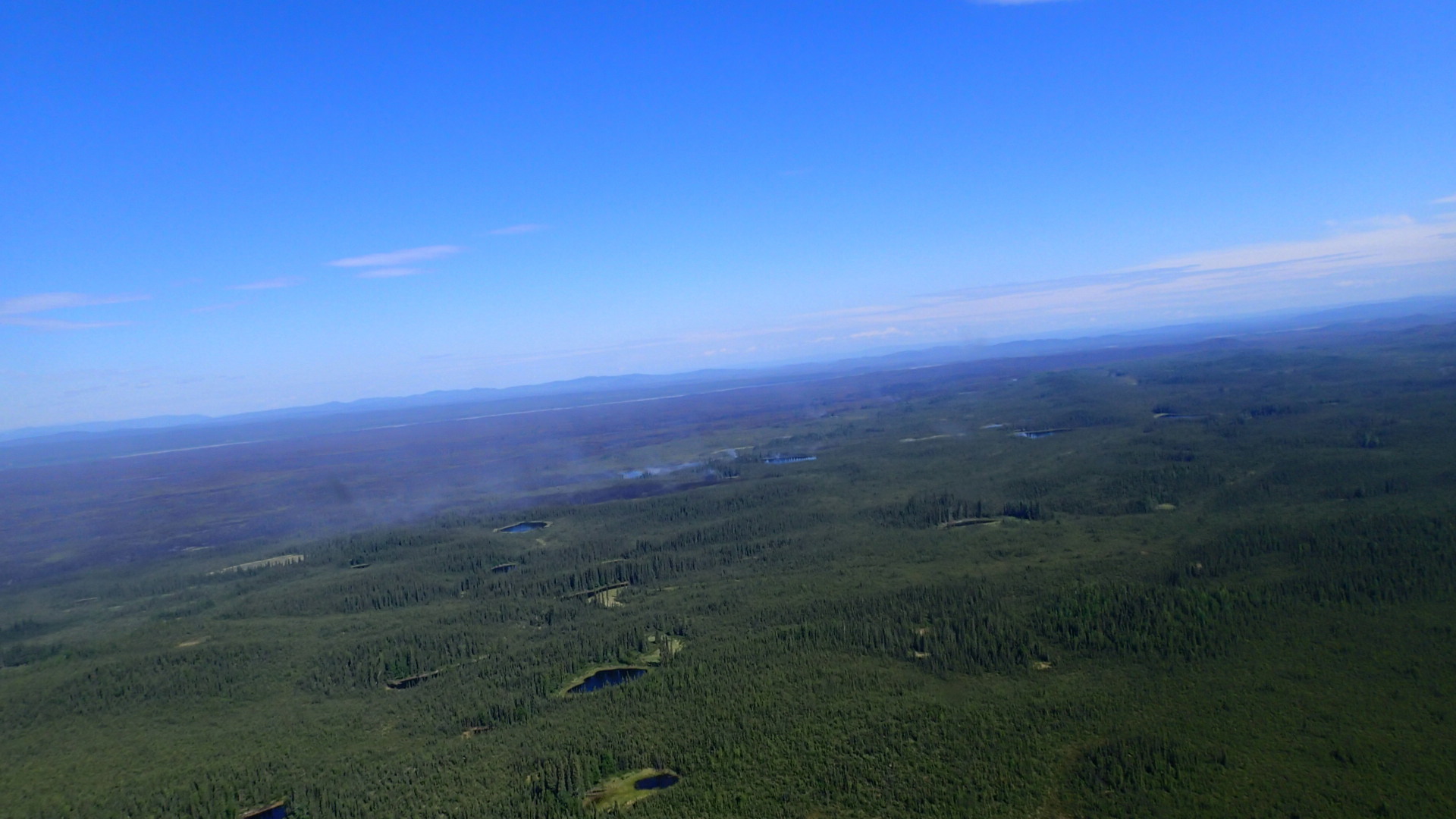
Toklat East River Fire, Denali NP, 2013, Photo by Yasunori Matsui (Photo credit: AlaskaNPS)
DENALI PARK, Alaska: Eight smokejumpers were deployed late yesterday to provide structure protection to two historic ranger patrol cabins potentially threatened by the Wigand Creek and Toklat River East Fires, which will likely burn together today. The Lower Toklat cabin, built in 1931 and located approximately 23 miles north of the Denali Park Road, is approximately .8 mile west of the Toklat River East Fire. The East Fork cabin is about 4.5 miles east of the Toklat River East Fire. It was constructed in 1930 and is about 18 miles north of the road. The National Park Service fire crews removed shrubs, trees, and other potential fuel from the vicinity of the cabins within the past five years as part of the park's hazardous fuel treatment program. The smokejumpers are tentatively planning a burnout operation at the Lower Toklat Cabin as it is more at risk due to the fire's proximity. The jumpers at the Lower East Fork Cabin will do hose lays and prepare a sprinkler system.

Denali fire managers were able to fly over the park yesterday and map the fires that were not obscured by smoke. There has been minimal change in the size of most of the fires burning in the park.

The Beaver Log Lakes Fire is now 63,000 acres. Fire personnel will continue to mopup around the cabins and other structures where burnout operations took place on the north shore of Lake Minchumina.The Type 3 Incident Management Team (IMT) managing this fire and the 26,266- acre Moving River Fire will gradually downsize operations as fire conditions permit.

The more than 22,000–acre Sandless Lake Fire on the northern park boundary was mapped yesterday and observers saw active fire on most of its perimeter. Due to heavy smoke portions of the fire were estimated. Areas that burned in 2009 are to the north and west of the fire.

The McKinley River East Fire that is 14 miles northwest of Wonder Lake was mapped at 4,417 acres. Little fire activity was seen during yesterday's overflight. It is burning in an area adjacent the McKinley River where a large fire burned in 1986.It and other lightning-ignited fires burning in remote backcountry areas of the park are not threatening any critical park resources, and will continue to be monitored for any significant changes in activity.

Visit http://www.nps.gov/dena/parkmgmt/currentfireinfo .htm for current information about wildfires in Denali National Park and Preserve. This will be the last daily press release on Denali fires until fire activity changes significantly.

Fire danger for the park and surrounding area is moderate to high. The National Park Service is urging park visitors to be extremely cautious with anything that could start a wildfire. Campfires are discouraged, but they are permitted in the fire grates in three of the park's campgrounds.Fires are not allowed in the park's wilderness areas. Fireworks are not allowed in the park and will be confiscated. Persons using fireworks in the park may be prosecuted.

There are currently 109 active wildfires in the state. Where there is fire, there is smoke. Due to the current and expected statewide fire activity, park visitors should anticipate the possibility of varying levels of smoke in the park. Wildfire smoke information is available at http://dec.alaska.gov/air/smokemain.htm. Visithttp://fire.ak.blm.gov for statewide information and a map of the active fires.

Tuesday, July 2, 2013

Two New Denali Fires Detected - No Threats to Developed Areas

Grizzly bear in Denali National Park

DENALI PARK, Alaska: Two new fires were detected in Denali National Park and Preserve over the weekend. The McKinley River East Fire was confirmed on Friday evening, and is one of the more active fires burning in the park. The 2,561-acre fire is approximately 14 miles northwest of Wonder Lake and 11 miles west of Kantishna, just south of the site of a large 1986 fire adjacent to the McKinley River. It is not threatening any developed areas or other critical resources. The other new fire, the Chilchukabena Lake Fire, is approximately ¼ mile north of the Moving River Fire and will likely merge with it soon. It is estimated to be 550 acres.

The lightning-ignited fires burning in remote backcountry areas north of the Denali Park Road are also not threatening any critical resources and, with the exception of the Toklat River East Fire, have shown no growth. The Toklat River East Fire has been actively burning and smoke columns may be visible from the Toklat area of the Denali Park Road. It is currently 48 acres in size. The Wigand Fire and Wyoming Hills fires have shown little activity and are one acre or less in size. The Sandless Lake Fire near the northern park boundary was recently mapped for the first time and is currently 8,445 acres.It is 80% active with some torching. The Bear Creek Fire approximately 15 miles northwest of Kantishna is 1,132 acres. All of these fires will continue to be monitored for any significant changes in activity.

The National Park Service fire crew assessed the Brooker Mountain and Xerxes wildfires, located in Kantishna and near Wonder Lake, and both have been declared out.

The Moving River Fire located approximately 30 miles northwest of Kantishna is now at 26,250 acres, with its primary growth to the south. This fire is being managed by the Type 3 interagency incident management team at Lake Minchumina.

The Beaver Log Lakes Fire is also being managed by the Type 3 interagency incident management team.The fire has increased to 59,000 acres, an increase of 4,000 acres since June 29. Most of the acreage is outside Denali National Preserve. Fire personnel have initiated structure protection and where applicable are burning out areas around cabins and other buildings on the north shore of Lake Minchumina.

Visit http://www.nps.gov/dena/parkmgmt/currentfireinfo.htm for current information about wildfires in Denali National Park and Preserve.

Fire danger for the park and surrounding area remains high to extreme. The National Park Service is urging park visitors to be extremely cautious with anything that could start a wildfire. Campfires are being discouraged, but they are permitted in the fire grates in three of the park's campgrounds.Fires are not allowed in the park's wilderness areas. Fireworks are not allowed in the park and will be confiscated. Persons using fireworks in the park may be prosecuted.

There are currently 116 active wildfires in the state. Where there is fire, there is smoke. Due to the current and expected statewide fire activity, park visitors should anticipate the possibility of varying levels of smoke in the park. Wildfire smoke information is available at http://dec.alaska.gov/air/smokemain.htm. Visit http://fire.ak.blm.gov for statewide information and a map of the active fires.

Saturday, June 22, 2013

Rain takes toll on Wrangell-St. Elias's Chisana Blaze

Rain has helped to slow the growth of the Chisana River Fire and moderated the
spread of smoke. The fire, which was started by lightning on May 21, has grown to 29,910 acres.The fire made small movements to the east in parts of Wrangell-St. Elias National Park and the Tetlin National Wildlife Refuge.It remains approximately 13 miles from the Alaska Highway and 18 miles west of Beaver Creek, Yukon, Canada.

The State of Alaska Division of Forestry is monitoring the fire closely and consulting with the fire management officers from the U.S. Fish and Wildlife Service, National Park Service, and Yukon Territory in Canada. Despite the rain, vegetation in the area remains dry and conditions can change rapidly. Fire managers will take action if structures or natural or cultural resources are threatened, based on statewide firefighting priorities and resources available. None are threatened at this time.

The fire has created a smoky haze over the Alaska Highway, however visibility remains good.If smoke impacts the highway, motorists are asked to use caution by slowing down and driving with their headlights on.Updated information on travel conditions can be found at http://511.alaska.gov.

Wildland fire smoke information is available at http://www.dec.state.ak.us/air/smokemain.htm.

A Fuels and Fire Behavior Advisory remains in effect for most of Alaska, due to record heat and dry fuels.Read more at: http://fire.ak.blm.gov/content/weather/outlooks/FFBehavior.pdf.

Information will be updated when significant changes in fire activity occur. . Information about fires burning on National Park Service lands throughout Alaska is provided at http://www.nps.gov/wrst/parkmgmt/currentfireinfo.htm

Saturday, June 15, 2013

Four lightning caused wildfires in northeastern Wrangell St Elias NP, two active, one quiet, one out

Copper Center, Alaska – A new wildfire was spotted by State of Alaska Division of Forestry (DOF) fire staff June 11 in northeastern Wrangell-St. Elias NP. The Bruin Creek fire is 73 miles southeast of Slana, 22 miles northeast of Chisana, 28
miles west of Beaver Creek, Canada and 16 miles southwest of the Chisana River Fire. At 2 acres, the fire was inactive except for a few smokes. Wrangell-St. Elias NP and DOF fire staff will monitor the fire closely.

Two park cabins are nearly 3 miles southeast of the Bruin Creek Fire. Today six interagency fire staff will remove brush around the cabins to make them defensible should the fire activity increase and advance toward the structures. Staff will also set up sprinkler kits in order to wet down the structures and reduce the fire risk. Temperatures in the area are expected to stay warm and dry.

The Chisana River Fire located 82 miles east of Slana, 37 miles northeast of Chisana and 19 miles northwest of Beaver Creek, Canada is 3175 acres. The majority of the fire burns in the Tetlin National Wildlife Refuge. Twenty-nine acres are in northeastern Wrangell-St. Elias National Park. The U.S. Fish and Wildlife Service, Wrangell-St. Elias NP and DOF fire staff will continue to monitor the fire, documenting fire behavior and growth. Staff are allowing the fire to take its natural course for the health of the boreal forest. Interagency fire managers will take action if structures, natural or cultural resources are threatened.

A quiet Edge Creek Fire was reported June 12. Less than ¼ acre, the fire is located just north of the Bruin Creek Fire and will be monitored by Wrangell-St. Elias and DOF fire staff.

When detected June 5, the 1 acre Tractor Trail Fire was out. Located south of the Bruin Creek Fire, it likely was ignited by lightning, burned for a short period of time and then rain extinguished it.

Naturally-caused wildfires have on occasion burned in the northeastern portion of Wrangell-St. Elias. Visit http://www.nps.gov/wrst/parkmgmt/loader.cfm?csModule=security/getfile&pageID=385664 to see a map of the park's wildfire history.

Visit http://www.nps.gov/wrst/parkmgmt/currentfireinfo.htm for current fire information.

For additional information please contact Mark Keogh at 907-822-7223.