Saturday, June 30, 2012

Mountaineer Dies in Ski Descent of Mount McKinley


TALKEETNA, Alaska: A 36-year-old Finnish mountaineer died from injuries incurred in a fall while descending Mt. McKinley the afternoon of Wednesday, May 23. Ilkka Uusitalo of Oulu, Finland was skiing down the 40- to 45-degree slope known as the 'Orient Express' with two teammates when he fell from an elevation of 17,800 feet and was unable to self-arrest. Uusitalo tumbled through snow, ice, and rocks, coming to a stop in a crevasse at 15,850 feet.
While one of his teammates continued down to the NPS ranger camp at 14,200 feet for rescue assistance, Uusitalo's other teammate rappelled into the crevasse with the help of a nearby team. They determined that Uusitalo was likely deceased.
An NPS response team arrived on scene approximately one hour later, and Ranger Tucker Chenoweth was lowered 60 feet into the crevasse by his team of 3 volunteer rangers. After confirming that Uusitalo was deceased, the NPS patrol members hauled both Chenoweth and the victim out to the glacier surface. Soon after, Uusitalo's body was evacuated via a long line operation by the park's A-Star B3 helicopter to the Kahiltna Basecamp, then on to Talkeetna.
This accident is the second fatal fall on Mt. McKinley this climbing season. Since 1972, 16 fatalities have occurred during descents of the Orient Express.

Wednesday, June 20, 2012

BLM to Premiere New Film at Arctic Interagency Visitor Center in Coldfoot

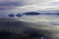
Arctic Ice Bergs
Arctic Ice Bergs (Photo credit: Polar Cruises)
FAIRBANKS, Alaska — The Bureau of Land Management will celebrate the release of a new film, Arctic Visions & Voices, with a reception and screening at 7 p.m. on the summer solstice, June 21, 2012, at the Arctic Interagency Visitor Center in Coldfoot.

Inspired by the unique environments and people of northern Alaska, the 15-minute film was produced by Post Modern Company of Denver, Colorado, for viewing in the visitor center’s auditorium. The film’s release puts the final touch on the award-winning visitor center, which first opened to the public on the summer solstice in 2004.

Arctic Visions & Voices shows the starkly beautiful and sometimes ferocious arctic environment and the different ways people value the area. It entices viewers to go out and explore further – to touch the tundra, listen to the songbirds, and dip their toes in the Arctic Ocean. Featured in the film are a highway equipment operator, a truck stop manager, a permafrost scientist, local residents, wildlife biologists, visitors, backcountry guides and the spectacular landscape itself.

The film, like the visitor center for which it was made, is the result of a long-standing, cooperative effort between the BLM, the National Park Service, and the U.S. Fish & Wildlife Service.

The Arctic Interagency Visitor Center is open in summer from 10 a.m. to 10 p.m. daily. For more information, call 907-678-5209 or visit the BLM’s Dalton Highway website at www.blm.gov/ak/dalton.

Monday, June 18, 2012

Photo contest and posters highlight Alaska’s National Forests

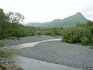
English: Erin McKittrick, www.groundtruthtrekk...
English: Erin McKittrick, www.groundtruthtrekking.org, own work Category:Images of Alaska (Photo credit: Wikipedia)

Chugach and Tongass National Forests Partner with Alaska Geographic to launch creative campaign
Contacts:
Erin Uloth, Tongass National Forest
euloth@fs.fed.us,  907-228-6201 or @TongassNF

Sara Boario, Chugach National Forest
sboario@fs.fed.us, 907-317-0756 or @ChugachForestAK
The Tongass and Chugach National Forests are kicking off a summer-long story and poster series this week with a statewide, social-media-driven photo contest highlighting the beauty and diversity of these unique community assets.

Photo Contest
The contest, conducted in partnership with Alaska Geographic, will feature the popular smart-phone application Instagram and will invite residents and visitors alike to share photos of the Forests throughout the summer. Winners will receive a copy of the “Tongass National Forest” or “Chugach National Forest” coffee table books published by Alaska Geographic, a set of the posters and a collectable pin. Check out the photos on Instagram and set up an account to vote for your favorite!

Poster Series
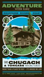
chugach poster thumbnail tongass poster thumbnail
The contest and story series are designed to build on 2011's International Year of the Forest by recognizing the connection between Alaskans and their backyard forests and to find new ways to explore and recreate in them. This year, the Forests are also presenting two new collectible posters with the themes “Adventure within Range” and “Rooted in Community.” The new posters are out now and available free to anyone who wants one; stop by your local Forest Service office to pick up one or both. And if you missed it last year, we still have a few of the International Year of the Forest posters left!

Story Series
While Instagram and the posters explore the community and adventure themes through imagery, stories also shape these places. Each month, the Forests will release a new set of stories related to these themes, drawing out just how fundamental community and adventure are to the Alaska lifestyle. The stories, which will all be posted at www.myalaskaforests.com, will highlight people, communities, activities and events you may not be aware of from the Forests—but that help shape and define these special places.

To kick things off, check out the following stories:
Twitter Conversations
These stories are not the only stories out there—we want to hear about your experiences, favorite places and thoughts about the forest landscapes and neighboring communities. In addition to the Instagram competition, which will tell our stories through pictures, the Forests will be posing a “question of the week” on Twitter, inviting thoughts and reflections on specific places or experiences.

Get out there!
Some of those experiences might come at one of the many events and activities happening across both Forests this summer, such as fishing days, Get Outdoors day, and BioBlitz—go to myalaskaforests.com for a full listing. And if you’re looking for other ideas for where to go in the Forests, download the Alaska App in iTunes and search for the Tongass or Chugach. New material is going online all the time, so check back often!

Photo competition details: Photo competition will run from now (June 7) through until 5:00pm (AKDST) on July 15. Photos posted on Instagram and Twitter must be hashtagged with “#myakforests”.  Please also include a brief description of where the photo was taken, including which forest. If you link your photo to Twitter, be sure to mention us, @TongassNF or @ChugachForestAK.

As of 5:00pm (AKDST) on July 15, the photo from each forest with the most “likes” will win. There will be two winners, one for each forest. Winners will be notified within Instagram as a comment on their photo as well as a photo announcement. Winners will be asked to send the photo by email along with mailing address for sending awards.

Winners will receive a coffee table book about the forest they photographed, a set of the posters, and a pin from Alaska Geographic.

Wednesday, June 6, 2012

Proposal for Russian River campground

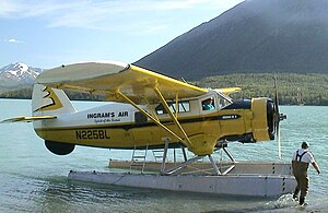
English: Picture of a Norseman still operating...
Picture of a Norseman still operating as a charter in Cooper Landing, Alaska.  (Photo credit: Wikipedia)
The Forest Service is proposing to reconstruct portions of the infrastructure at Russian River Campground near Cooper Landing, AK. We are starting an environmental assessment and would like to understand your comments or concerns with these proposed actions. By early next week we will have a letter with maps loaded onto the Chugach National Forest website.


f you have more questions about the project, please contact:

  • John Eavis: 288-7701
  • Karen Kromrey (after June 23): 288-7745. 

Tuesday, June 5, 2012

Russian RIver Fishing Season Approaching

Russian river Alaska
Russian river Alaska (Photo credit: Wikipedia)
Cooper Landing, Alaska—The Russian River opens to fishing June 11. This popular area for fishing results in a mixture of people, fish and bears. The Kenai-Russian River area is an intensively used fishing and recreation area, valued by anglers, federally qualified subsistence users, and other visitors for its easy access. High human use between the months of May and September, coupled with abundant fishery resources, has led to public and employee safety concerns and impacts to the resources in the area.
Visitors are requested to respect the areas that are fenced or roped off to protect restored vegetation and cultural sites. Visitors should to stay on maintained and established trails and boardwalks. Visitors are also strongly requested to use the public restroom facilities that are dispersed throughout the area due to the potential of disturbing sensitive cultural sites along the river corridor.

“Alaska Natives have used this area, known as the Sqilantnu Archeological District, for centuries. The area is one of the most complex archeological sites in Alaska and it is up to all of us to leave a legacy of responsible use that we can be proud of,” said Sasha Lindgren, Kenaitze Indian Tribe.

Monday, June 4, 2012

Whale Waters Update for Glacier Bay Effective May 25, 2012

Glacier Bay National Park and Preserve Superintendent Susan Boudreau announced today that a vessel speed limit of 13 knots through the water will be implemented in the middle of Glacier Bay to protect numerous humpback whales that have been sighted in this area. During the past week at least 19 different humpback whales, including a mother/calf pair, have been observed in this area. This speed restriction will apply to all vessels from 5AM Friday May 25 until further notice.
As shown on the attached map, the designated 13-knot whale waters in the middle of Glacier Bay are as follows:
  • southern boundary: a line from the northern tip of Strawberry Island to the northern tip of Lars Island, contiguous with the northern extent of lower Glacier Bay whale waters
  • eastern boundary: a line from the northern tip of Strawberry Island to the western tip of Flapjack Island, then following the motorless waters boundary to Bear Track Cove, and then following the eastern shoreline of Glacier Bay north through South Sandy Cove.
  • northern boundary: a line drawn from the northern edge of South Sandy Cove to the northern tip of North Marble Island to the southern tip of Drake Island and then due west to the mainland shore
  • western boundary: follows the western shoreline of Whidbey Passage from due west of the southern tip of Drake Island to the northern tip of Lars Island, not including the waters of Fingers Bay or Berg Bay
  • Note that a large portion of Whidbey Passage is included in these whale waters, along with Bear Track Cove, South Sandy Cove, and Spokane Cove 
Since May 15th, Lower Glacier Bay whale waters have been in effect in the waters extending from the mouth of Glacier Bay (a line between Pt. Gustavus and Pt. Carolus) to a line drawn between the northern tip of Strawberry Island and the northern tip of Lars Island, including Bartlett Cove. This boundary is shown on NOAA nautical charts of Glacier Bay. All vessels passing through this area are restricted to a speed limit of 20 knots through the water. In addition, vessels greater than 18 feet in length passing through this area are restricted to a mid-channel course or 1 nautical mile offshore.
Boaters are reminded that vessels are prohibited from operating within ¼ nautical mile nautical mile of a humpback whale in Park waters, including those Park waters outside Glacier Bay proper. In addition, vessel operators positioned within ½ nautical mile of a humpback whale are prohibited from altering their course or speed in a manner that results in decreasing the distance between the whale and the vessel. Speed and course restrictions in whale waters are intended to reduce the disruption of feeding humpback whales and to lower the risk of whale/vessel collisions. Boaters should proceed cautiously in all areas where whales are present because whales may surface in unexpected locations, posing a hazard to both the vessel and the whale. Although humpback whales sometimes tend to be distributed along the shoreline, boaters should note that whales frequently cross mid-channel as they move between feeding sites.
Boaters are advised to verify whale waters designations prior to entering Glacier Bay by telephoning (907) 697-2627 or by contacting KWM20 Bartlett Cove on marine VHF radio.
Whale waters restrictions are authorized in Glacier Bay National Park in accordance with Title 36 of the Code of Federal Regulations, Subpart N, 13.1174.